.png "back to home page")
Google Maps pushed me a question about how crowded my subway was pic.twitter.com/wwApt8j2zb
— Jeremy Fisher (@jeremyhfisher) August 5, 2018
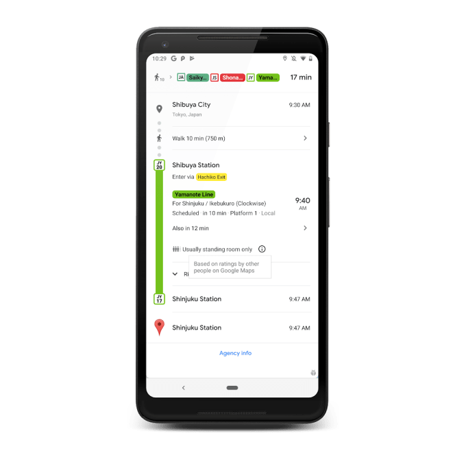
Google Maps just added a cool new feature https://t.co/rYPY7iFocH pic.twitter.com/Xxoit4mlWO
— FutureShift (@futureshift) June 27, 2019
The world's most crowded transit lines according to @google - @Ligne13_RATP is #5 https://t.co/KxWbxqmANv pic.twitter.com/i6Lml9rtv2
— Jérôme Derozard (@derozard) June 27, 2019
Transit crowdedness trends from around the world, according to Google Maps @google https://t.co/cApS0nPgtL
— Barry Schwartz (@rustybrick) June 27, 2019
이제 Google 지도에서 버스나 기차가 얼마나 혼잡한지 알려줄 수 있습니다. https://t.co/tLq5OFAZYZ
— editoy (@editoy) June 28, 2019
구글맵의 이 신기능 대중교통 기능의 흥미로운 점은 공공API(서울의 경우 버스카드로 +/- 계산)를 쓴 것이 아니라는 점.
— Goodhyun 김국현 (@goodhyun) June 28, 2019
과거 사용자 데이터를 통한 예측이지만, 더 나아가면 실시간 계산도 가능할지도. 차량내 사용자를 산출하고 결과값을 보정하면 ?https://t.co/zN53W4E6XF
What you can do with massive data: Google Maps launches real-time public transport times and predictions of how crowded they will be in 200 cities today.https://t.co/QXliP1D6HH pic.twitter.com/2uRdtOytEX
— Ross Dawson (@rossdawson) June 27, 2019
Google Maps can now predict how crowded your bus or train will be | TechCrunch https://t.co/NcWPeoOvu8
— Hazem Zureiqat (@hazem) June 28, 2019
You can now see how crowded your commute may when using @googlemaps in more than 200 cities, impressed to see Buenos Aires three times in the top 10! https://t.co/rFPCMOBBaW pic.twitter.com/VML5qwxdJ7
— Bruno Belcastro (@argen) June 28, 2019
どの程度で混雑してると感じるかは地域によって違いそう / Transit crowdedness trends from around the world, according to Google Maps @google https://t.co/OSxpMQd6Ju
— yteraoka (@yteraoka) June 28, 2019